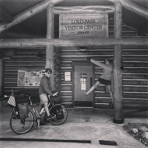
This week, we followed the route of the great explorers Lewis and Clark, taking the Northwest Passage into the Rockies. Crossing Lolo Pass into Montana was one of the most scenic roads of the entire trip, while our climb over White Bird Hill through the extreme heat of the day was one of our most difficult experiences to date.
We met some good people this week, including John and his friends Tom and Sarah up towards the top of Lolo Pass. John is an inspiration to us. He has muscular dystrophy and is cycling solo across the country to raise money for MDA. What a badass, right? I highly encourage you to check this link and consider donating to this cause. We are going to... And we are unemployed 😉. Let's help him reach his goal!!
We also made a new Russian friend, Fedor, coming the other direction (down but against the wind), who is only 2 states away from reaching the coast and completing his cross America trip. Oddly, his wife works in Boston, so we will likely be grabbing drinks together to recap things in a few months 😀. Small world.
Distance: 221 Miles
Elevation Gain: 14,340 feet
Campgrounds
River Junction RV Park (Kooskia, ID): This RV park allows tent camping for $15/per tent. Showers are hot and coin operated. We used just one quarter and it powered the shower for over 5 minutes. The grounds are right on the river, and though they are not super well maintained, it was good for a night’s rest. The town of Kooskia is only 1 mile away, so it’s easy to bike and grab supplies after setting up camp.
Lochsa Lodge (Lochsa, ID): At the lodge, here is a campground (Powell) if you head a bit further down the road. It’s $14/site. However, for bikers, it is free to camp behind the country store! Just ask the store owner first. Showers are $5/person. The store has lots of food and supplies, and there is also a restaurant nearby, which has amazing breakfast. When we camped, it was a little noisy due to all the tourists, but it wasn’t a huge deal. I 100% recommend this if you need a place to rest up before finishing the climb over Lolo.
The Route Deets:
Departing Riggins, we enjoyed 30 miles downhill along the river and through the canyon. We stopped a bunch to check out all the historic sites on the roadside and to learn more about the formation of the area and the Nez Perce tribe that populated it.
When we arrived in White Bird, taking the town exit off the 95, we began our long ride to the top of the hill. This was the most difficult climb we’d done up to this point in the trip. The road is steep, there was no shade to protect us from the beating sun, and the climb just never seemed to end. Upon reaching the top of the first set of switchbacks, we were demoralized to round the corner and see another set. While we survived, a word of caution that this climb is no joke.
Descending into Grangeville was gradual and along lightly trafficked roadways. In town, we got off the main road and took farming roads north, stair stepping our way along rolling hills before a steep descent into the town of Stites. Make sure your brakes are in good shape for this descent, as it winds and drops quickly over 4 miles.
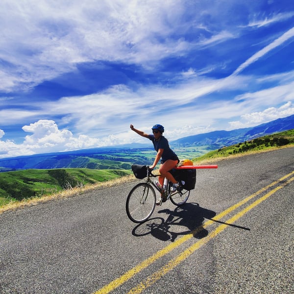
We then followed the 12 into Kooskia, after which we turned right towards the climb up to Lolo Pass. This road was one of our favorites on the whole trip. The road follows the river along the Northwest passage and is full of epic mountain views and historical sights related to the Lewis and Clark expedition. We rode the first day all the way to Lochsa Lodge (88 miles from Kooskia) and then completed in the second day, falling all the way down into Missoula.
Make sure you stock up on supplies in Kooskia or Syringa, as there is nothing in the way of supplies until you reach the lodge. There are a few campgrounds, and we know that Jerry Johnson has running water, but it’s best to climb prepared along this 100 mile stretch.
After reaching the visitor center at the top of the pass, we followed the gradual slope down into Lolo. Welcome to Montana! The forest seemed to change a bit on our ride, marked by far more rocky structures among the evergreens. In Lolo, we caught the bike path, which led us away from the busy highway and remained with us all the way into Missoula.
For more on where we've been and where we are headed next, don't miss out on this page: Biking the US.
Topics: Camping, Maps and Routes, USA